
Earth Observation for Oil and Gas (EO4OG)
Article by Andrew Cutts, www.acgeospatial.co.uk/
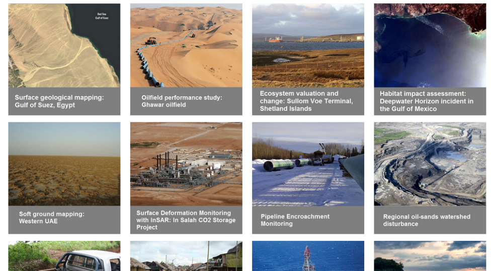 Image from the EO4OG webpage (accessed July 2016)
This project was initiated by the European Space Agency (ESA) and the International Association of Oil and Gas Producers (IOGP) in 2014. The aim was to “to undertake a comprehensive study of the geo-information needs of the O&G sector and what EO services / products could help meet those needs”. The starting point to access this information and the project itself is here: https://earsc-portal.eu/display/EO4/EO4OG+Home
Hidden Gems
There are quite a few hidden gems in this project; I will highlight two key ones. Firstly, there are 19 case studies. https://earsc-portal.eu/display/EO4/EO4OG+Case+Studies+-+gallery+style well worth having a look at.
They are split into Onshore and Offshore case studies, but each one contains a tab either called ‘Outcomes’ or ‘Results & Perspectives’. Why is this a hidden gem? Because the value of EO products is being highlighted in real world Oil and Gas related activities.
Secondly, the challenges faced by the Oil and Gas sector have been presented in the form of challenge trees. Here for example is a snap shot of Surface Geology Mapping. https://earsc-portal.eu/display/EO4/EO4OG+Challenges+-+Surface+Geology+Mapping
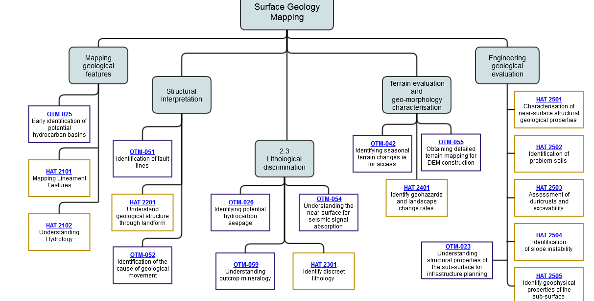 Image from the EO4OG webpage (accessed July 2016)
These challenge trees allow quick navigation to subsections (in grey), with the actual challenges within those sections. Click on a challenge and it will take you to the product sheet. There is a significant amount of rich content in these pages; I wonder if enough people have come across them.
225 challenges
Between them the four consortiums found 225 challenges. These challenges originated from interviews with Oil and Gas companies. There is some overlap in the challenges and it would be great if the two onshore and two offshore projects could be merged. The challenges found by each consortium are coloured by the bounding box (in the example above OTM is blue/black and Hatfield is Orange/Brown). There is no repetition within each consortium’s challenges.
I have done a 6-minute guide to navigating through the web site on YouTube, although the site is pretty intuitive.
A stunning return on public investment
Earth Observation (EO) data should be a more attractive proposition today than ever before. The USGS suggests the Landsat program is “a stunning return on public investment” http://landsat.gsfc.nasa.gov/?p=9654. Since the free and open data policy start in 2008 the number of downloaded scenes has increased exponentially.
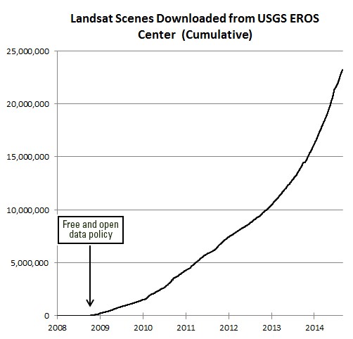
The rate of downloads of Landsat data is increasing rapidly. Image credit: USGS.
Conclusion
EO data has in the past been oversold to the Oil and Gas Sector. The rapid improvement in spatial and spectral resolution, added to the increasing temporal coverage plus a move towards machine learning and ‘Earth Observation 2.0’ https://sa.catapult.org.uk/wp-content/uploads/2016/06/Geospatial-2.0-Catapult-presentation-20160713.pdf is making EO data more attractive today. The work produced by the EO4OG sets a framework to solve common industry problems. Time to look at EO again.